Argyll Forest & Arrochar Alps
This western part of the National Park has more than a hint of the sea – even the summit of the Cobbler, the most famous of the Arrochar Alps, is only two miles (three km) from the salt water of Loch Long.
Here too are the fringes of the old kingdom of Dalriada, where the Scots settled from Ireland. The name is recalled in the geology of the Dalradian rocks from which the area out to the west is built. The glacial deepening of the natural north-east to south-west grain of the land has in turn influenced settlement and transport around the fjord-like Lochs Long and Loch Goil. Roads such as the main route to the west, through Glen Croe, are hemmed in by steep sided hills, while communities are thinly scattered along the floor of the glens, or by the coast, in the case of Lochgoilhead and Arrochar.
Historically, the area is associated with the Clan Campbell. The Earls, then Dukes of Argyll, played important roles in Scotland’s political life for centuries. Later, as the coastal parts (at least) in places became more accessible with the development of steamer traffic, some fine Victorian country houses appeared. As seen in other parts of the Clyde estuary and its associated sea-lochs , these were often built as country retreats by city merchants and entrepreneurs
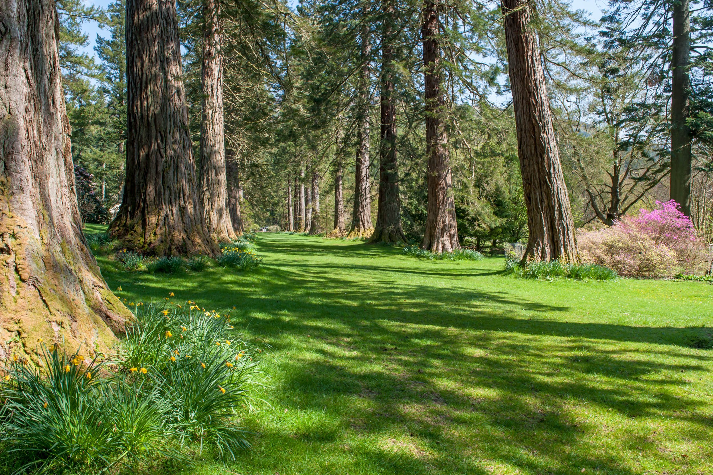
Today, the acid soils and higher rainfall (compared to parts of the park further east) are more than tolerated by the conifers of the Argyll Forest Park. This was the first forest park in the UK, as early as 1935 – the Forestry Commission well aware of the proximity of the Glasgow conurbation and the need for green spaces for weekend recreation for the city population.
Along with Dunoon and its Clyde ferry links, Arrochar is an important gateway to the Argyll Forest Park, a working forest that still fulfils its recreational role. There is an excellent choice of waymarked Argyll Forest Park walks and trails in several places, as well as off-road routes for cyclists. Angling is also popular in the area. Finally, in addition to the extensive plantings of conifers, some original native woodland still survives in places such as Hell’s Glen and Glen Finart – plus the mildness that prevails here allows the cultivation of frost-tender and less hardy species. See the exotic collections at Kilmun Arboretum and Benmore, an important outstation of the Royal Botanic Garden, Edinburgh.

Ardgartan
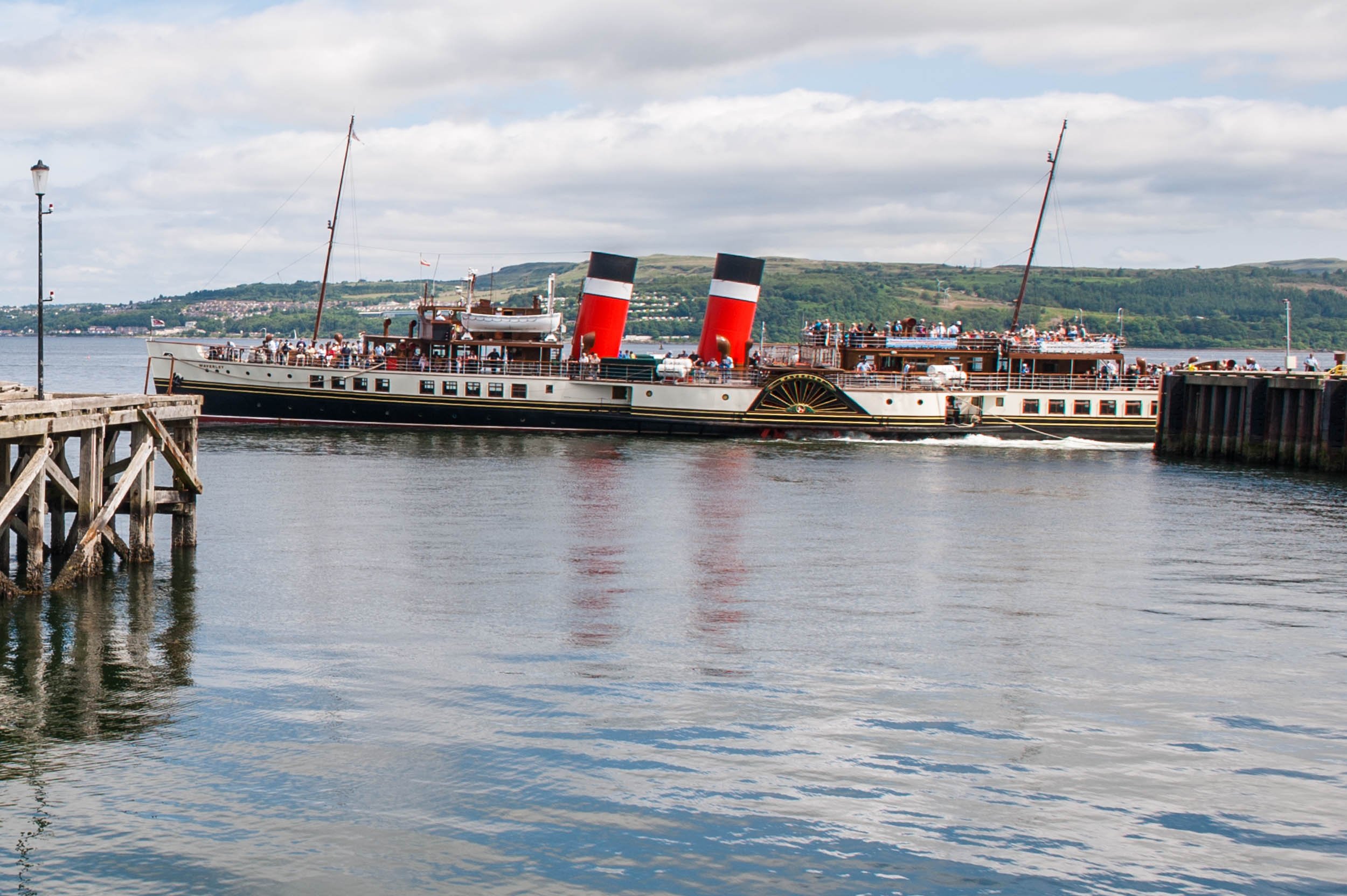
Dunoon

Loch Eck
Lochgoilhead

Puck's Glen
Arrochar Alps
Arrochar
Arrochar was once in the territory ruled by the Clan MacFarlane. Later, in much more peaceable times, it had its own pier and was part of the local steamer network. Ih the steamer heyday, Arrochar was where tourist disembarked as part of the ‘Three Lochs Tour’. This involved a steamship up Loch Long, passing Loch Goil, then a homeward leg from nearby Tarbet on Loch Lomond to Balloch for a return by rail to Glasgow. Today Arrochar still welcomes visitors, offering a good range of accommodation and places to eat, plus a great choice of local walking routes.
Loch Long
Loch Long is from Gaelic meaning ship-loch, perhaps even a folk memory of the famous Viking raid on Loch Lomond that involved the carrying of their boats across the isthmus to Loch Lomond.
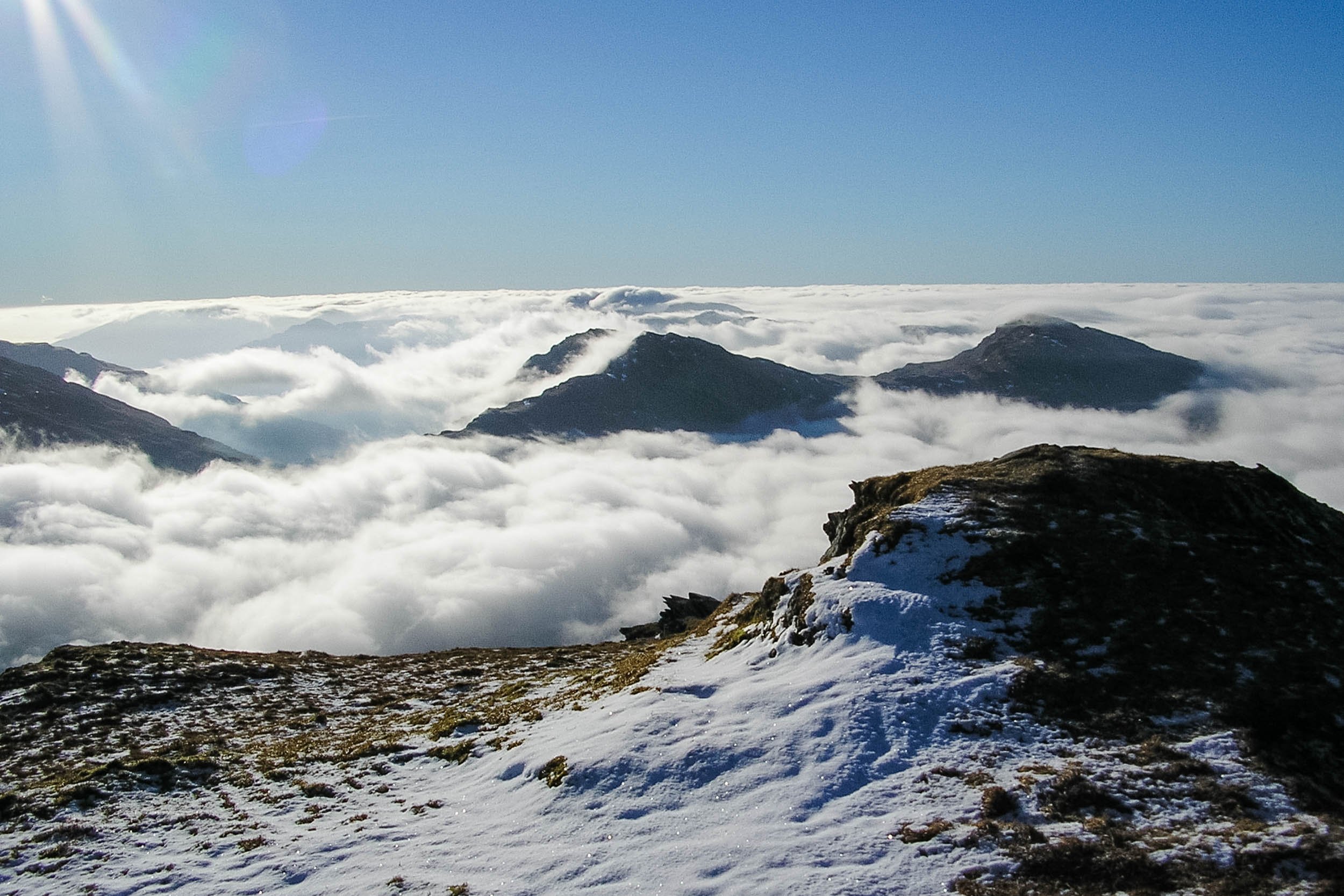
The coming of the railway to Arrochar also was to make the Arrochar Alps more accessible for weekend climbing parties from Glasgow. This range of five rugged peaks forms roughly a half-circle above the village. Four of the five reach 3000ft (914m), that magic height for hillwalkers, and qualify as Munros (a name given to Scottish peaks exceeding this figure). Yet the fifth is the best known. The Cobbler's knobbly skyline commands attention from several vantage points, including the A814 south of the village. At 2891 ft (881m) it is not on the 'Munro-bagging' list, but is still a very popular day out. Its crags also attract that other breed of hill enthusiast, the rock climber. There are about 70 climbing routes, the longest of which is 370ft (113m) on the North Peak.
Between 1912 and 1986, Loch Long was used for torpedo testing. The weapons, without warheads, were fired down the loch and recovered. A number of stories have passed into local folk-lore concerning torpedoes that went off-track, sometimes even coming ashore. The testing station, originally an Admiralty establishment and formerly an important local employer for the area, was immediately opposite Arrochar.
Ardgartan
Ardgartan is only a little further down the loch, on the west side. Plenty of walking and cycle trails go along the shore or into the woodlands here. (Otters, seeking crabs and fish close inshore, may be seen on a quiet lochside walk hereabouts.) The
Ardgartan also marks where the main road west climbs into Glen Croe to the road summit known as the Rest and Be Thankful - 806ft (244m) above sea level barely four miles (six km) back at Loch Long. This was a drovers’ route from the west, then a military road. Sections of an earlier road are obvious in the glen today, below the modern road. To the south of Glen Croe, the Ardgartan peninsula is not accessible by public motorable roads, hence is one of the wildest parts of the western side of the National Park.
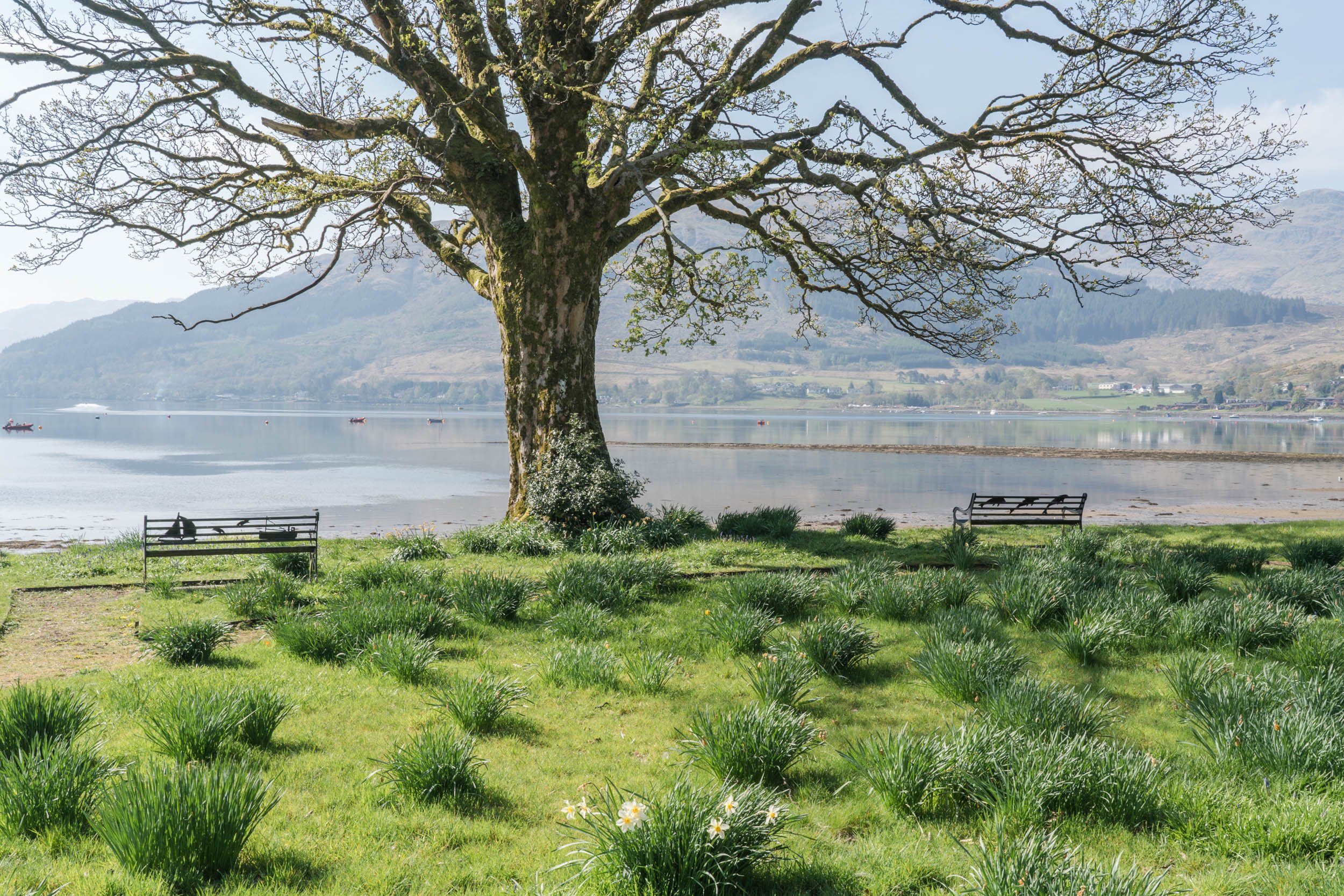
Lochgoilhead
From the junction at the Rest and Be Thankful, a narrow road snakes down to Lochgoilhead, with Loch Fyne also reachable via the inappropriately named Hell’s Glen. Lochgoilhead is, like Arrochar, a settlement on the head of a sea-loch, and one that benefited from the formerly extensive Clyde steamer network. It conforms to the area’s pattern of steamer services that in turn encouraged the building of country retreats in Victorian times. Lochgoilhead, with its choice of accommodation, outdoor centres, camping and caravan park and holiday village, is very much a place where leisure and tourism has an important role to play. Fishing, sailing and canoeing, and pony-trekking are all popular here.
The Loch Lomond & Coral Way comes in from Strachur to the west here at Lochgoilhead.
This walking route links Portavadie (Loch Fyne) with Inveruglas (Loch Lomond), running for around 57 miles (91km) through the wild landscapes of Cowal.
Castle Carrick
A reminder that this is very much ‘Campbell country’ is five miles (eight km) further down the loch. Castle Carrick was a Campbell stronghold dating from the 14th century.
The nature of the terrain means the main route further south into Cowal lies along the shores of Loch Fyne. From there a road leads down to Dunoon, re-entering the forest park near Glenbranter. (There is a Forestry Commission information room here as well.) Historically, this was the first land acquired in Scotland by the Forestry Commission, as long ago a 1921. The estate here belonged to the Scottish entertainer Sir Harry Lauder. (A memorial to his son, Captain John Lauder, killed in World War I, can be seen by the roadside.)
In common with other parts of the forest park, the Forestry Commission have ensured a good walking and cycling choice in the woodlands, including a longer route along to Loch Eck and beyond, down to Benmore. By Loch Eckside this route passes below the 'Paper Cave' on the slopes of Clach Bheinn. The cave‘s name is said to refer its use as a storage place in olden times for legal documents belonging to the Argyll Campbells
Loch Eck
Loch Eck, like Loch Lomond, was once a sea loch but rising land after the glaciers melted meant it became a fresh water loch – with an unusual community of fish species. These include the powan, a kind of fresh-water herring, found in Scotland only here and in Loch Lomond. The powan shares the loch with Arctic char as well as salon and sea trout.
Tall trees are also a feature of the Benmore Botanic Garden, in its mild and sheltered location north of Dunoon. There is an avenue of redwoods (planted in 1863), over 250 species of rhododendron, an extensive magnolia collection, a formal garden, a re-creation of a Chilean rainforest and a choice of waymarked trails, totalling at least 6miles (10km). Nearby is Puck’s Glen, where some of the most picturesque walks in the area can be found, in the shadow of giant redwood trees.
The River Eachaig drains Loch Eck into the Holy Loch, and over time has created extensive mudflats, creating a habitat for wading birds and an ambience in this part of the park that the visitor will find very different from the rugged terrain of the Cowal interior. The Holy Loch was a US Navy submarine base for thirty years until the early 1990s and the ending of the Cold War.
The community of Kilmun overlooks the loch, its original church founded inevitably hereabouts by a Campbell, Sir Duncan, in 1442. His effigy is in today’s church, while others of the clan lie nearby. Kilmun Arboretum dates from the 1930s and was a testing ground for tree species to see which ones thrived in the mild but frequently wet climate of the area. Over 300 species have been trialled here, with more than 160 to be seen today on the waymaked trails round the plantings.
Finally, the road beyond Blairmore goes along the coast to Ardentinny, with its sandy beach – an unusual feature in Cowal! The coastline beyond is roadless until Castle Carrick.
Dunoon
Dunoon is the important southern gateway to Cowal and the National Park. Visitors, taking advantage of the Clyde ferry connections that link Dunoon with the main road (and rail) connections from the south and east, reach the Park boundary at the head of the Holy Loch. The well-resourced town itself has a long tradition as a Clyde coast resort in the heyday of the steamer services and is still a popular destination.