
Walking in the National Park
(Picture: Beinn Dubh, Luss)
The walking choice in the Loch Lomond and Trossachs National Park area is huge. From Glenbranter in the west to the Bracklinn Falls above Callander in the east, and similarly from the demanding heights of Ben Lui in the north, to the rewarding stroll up Duncryyne Hill near Gartocharn in the south, there are walking routes for all abilities and degrees of fitness. These even include well-surfaced roads over which general traffic is not permitted – for example, around Loch Katrine, or up to the Loch Sloy Dam.
Much of the walking, especially in Forestry Commission areas, is signposted and/or waymarked. The National Park Authority publishes a series of walking guides for various parts of the park. Other guides are available from the Friends of Loch Lomond and The Trossachs on-line shop
There are, of course, natural clusters of walks and walking centres. Aberfoyle, on the Highland Boundary Fault, is just one. It also offers access to the extensive Loch Ard Forest. Other natural centres include the head of Balquhidder Glen, at Inverlochlarig, starting point for a number of Munros; while Killin, Crianlarich and Arrochar are other good walking bases. The Argyll Forest Park in Cowal also has plenty to offer. Finally, there are the ‘official’ long distance footpaths, most notably the West Hghland Way that offer through routes in the Park.
Duncryne
Just to the south of Gartocharn, a rewarding walk up to breathtaking panoramic viewpoint northwards over Loch Lomond, its islands and the Highland hills beyond. Simply one of Scotland’s best views.
Easy, with short steep section. 2 miles (3.5km)
Aber Path to Loch Lomond NNR
Another pleasant walk close to Gartocharn (and starting from the Millennium Hall) for views across the southern end of Loch Lomond and its bird-rich marsh and wetlands. Bring binoculars! Suitable for all ages.
Easy and level. 3.5 miles (5.5km)
Inchcailloch
A short boat journey from MacFarlane’s Boatyard at Balmaha allows an island experience, via a nature trail path through mature oakwood and up to a 250ft (75m) high viewpoint with a grand northwards panorama up the loch.
Easy. 2.5 miles (4km)
Conic Hill
Behind Balmaha, a steady pull leads to the top of the humped ridge of Conic Hill, right on the Highland Boundary Fault, with the hill’s highest point at 1130ft (345m). The route is easily found by following West Highland Way signs. The views across the islands of Loch Lomond, the actual line of the boundary fault, are especially good.
Moderate, walking boots advisable. 3 miles (5km)
Balmaha millennium Forest Path
This waymarked and easy to follow route is a good way of sampling the special ambience of the ‘Bonnie Banks of Loch Lomond’. It also follows a section of the West Highland Way to a viewpoint overlooking the loch, Craigie Fort.
Easy. 1 mile (1.6km)
Ben Lomond
This is a full day excursion to high mountain terrain. Ben Lomond summit is at 3192 ft (974m) The circuit from the Rowardennan car-park to the top and the descent via Ptarmigan, 2398ft (731m) is a popular option.
Strenuous. Suitable footwear and walking equipment essential. c. 6 miles (10km) depending on descent route.
Ardess History Trail
Explore the archaeology hidden amid the woodland and bracken on this short trail. An insight into how this stretch of countryside housed and fed local families in days gone by.
Easy. 2 miles (3km)
West Highland Way – through Rob Roy country
Fromm Rowardennan, the West Highland Way takes woodland tracks by the loch to Inversnaid. Time it right for a ferry to Rowardennan from Tarbet and a return crossing to Tarbet from Inversnaid.
Moderate. Good footwear preferable. 9 miles (14 km)
Inversnaid nature reserve
Explore the Loch Lomondside oakwoods and the moorland above on a variety of interesting trails. (See also above). The area is managed by the Royal Society for the Protection of Birds and is noted for its summer visiting species, including pied flycatcher and various warblers. Black grouse are a feature of the moorland,
Easy. Various lengths.
Loch Sloy dam
A 182 ft (56m) high dam built from 1946 onwards is dwarfed by the scale of the mountains and is well worth the walk ‘round the back’ of Ben Vorlich from Inveruglas. Social history is here too: the dam was built by prisoners of war awaiting repatriation. A camp and a railway station were set up at Inveruglas to accommodate the workforce. It was also the first dam of its kind to be built by the North of Scotland Hydro-Electric Board. This walk gives a flavour of mountain country from the ‘security’ of a surfaced road!
Easy to moderate (depending on how far is walked). 7 miles (11km) round trip to dam.
Ben Lui
At 3707 ft (1130m) Ben Lui is a very big mountain by Scottish standards - the 28th highest out of 283 Munros - and its steep upper slopes mean it is dangerous in winter conditions in particular. At any time of year this is an all-day expedition for fit and well equipped walkers. A variety of routes are possible. Many walkers ascend from Glen Cononish, others start from the A85 roadside west of Tyndrum. Ben Lui is also a National Nature Reserve because of its Arctic-Alpine plants.
Strenuous. Full hill-walking gear essential. c. 12 miles (19km) (via Cononish Glen)
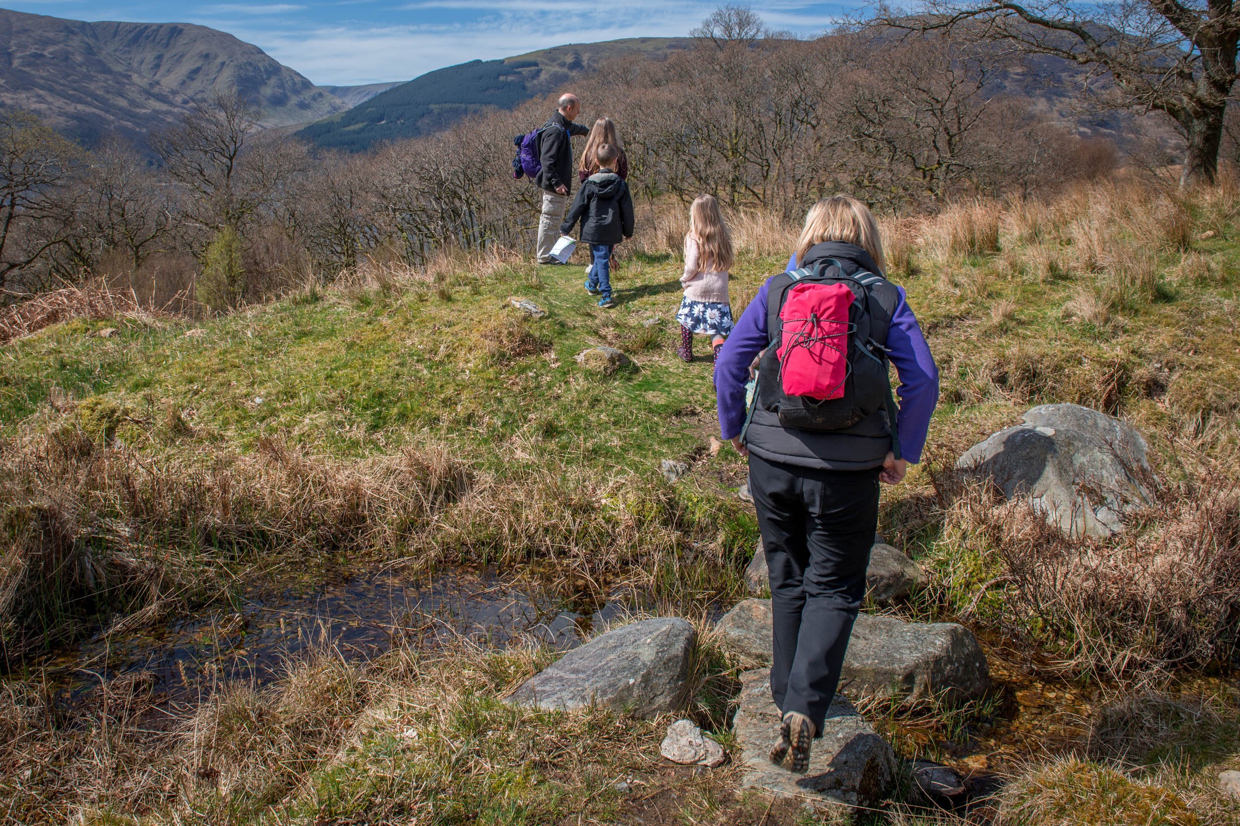
Walks from Luss (various)
From a start in the pretty village of Luss, there are a variety of walking options detailed in a National Park leaflet. The longest of these (about an hour) is a full circuit of the village including a picturesque riverside stretch.
Easy. Various, up to 2 miles (3km)
Ben Venue
A Trossachs hill that exceeds 2000 ft (610m) – so demands care – but gives superb views over the Trossachs lochs and west beyond Ben Lui. The starting point is a Forestry Commission car-park close to the Loch Achray hotel. The path reaches the summit from the western side of the hill and the safest return is by the same path.
Strenuous – allow plenty of time. Suitable footwear essential. c. 7 miles (10km) depending on descent route.
The Cobbler
The Cobbler (2896ft / 883m) has probably one of Scotland’s most instantly recognisable mountain profiles. The main path starts from Succoth car park to the west of Arrochar. The final ascent requires some scrambling, rock climbing and a good head for heights. Fine views of the Arrochar Alps.
Strenuous – hill-walking experience and good footwear essential. 7 miles (11km).
Ardgartan walks, Arrochar
Ardgartan Forest is part of the Argyll Forest Park, managed by Forestry Commission Scotland. There is a network of gentle, waymarked walks that can be combined with longer walks up Glen Loin and Succoth Burn. The popular Tarbet Isle Loop above Loch Lomond is also within easy reach.
Easy to moderate. Various lengths
Kilmun Arboretum
There is a good choice of waymarked routes amid the shelter of the trees here by way of navigating round the Forestry Commission’s woodland testing ground. Paths are well maintained with bridges and handrails in places.
Mostly easy. 2 miles (3km)
Puck’s Glen
This is one of the best known walks in Cowal, with a special character because of the lush and mossy growth, and the waterfalls, creating a kind of temperate rainforest. There are three walks to choose from, starting from a car park.
Easy to moderate. 2 miles (3km)
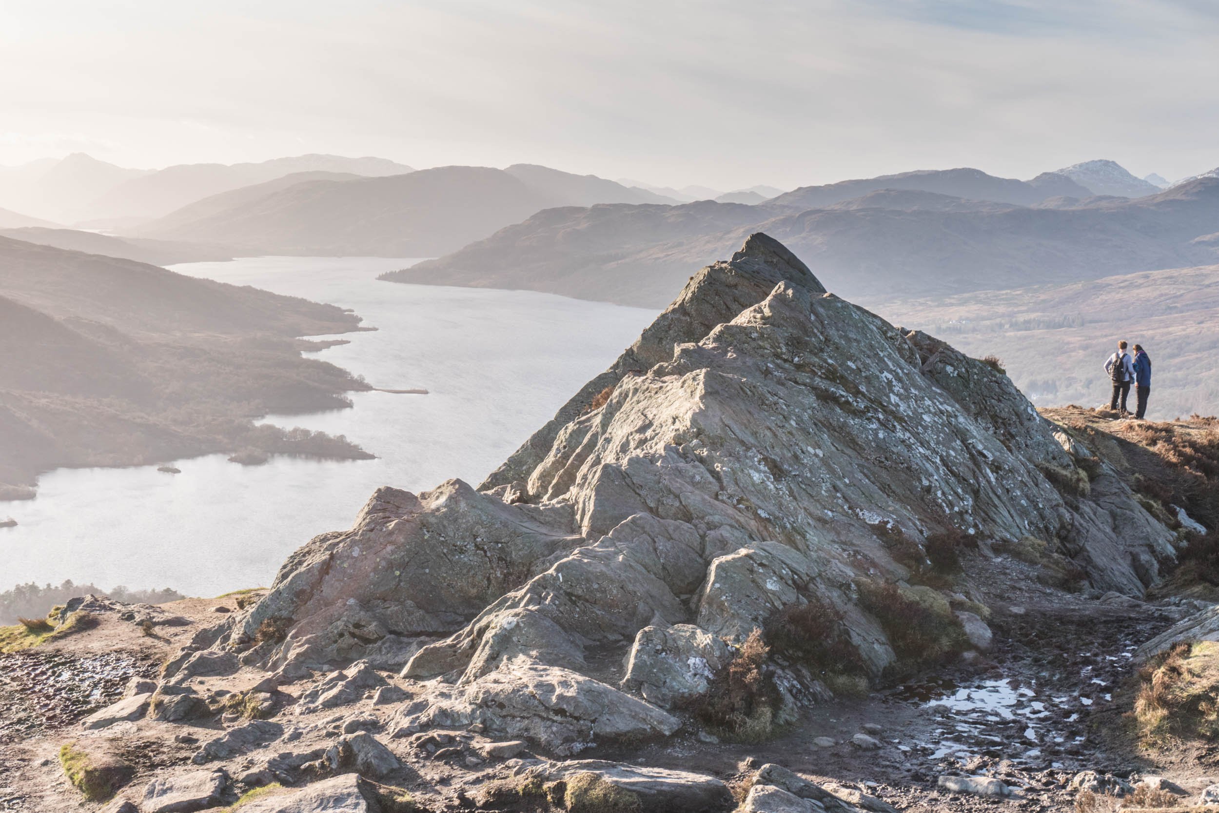
Ben A’an
A short but demanding ascent with a view out of all proportion to the actual size of the peak. Superb panorama over Loch Katrine in particular. Care needed on final steep section.
Moderate. 2 miles (3km)
Glen Finglas
Though sometimes overlooked, this glen running out to the north above Brig o’ Turk offers a good choice of walks and trails. It is in the care of the Woodland Trust. The dammed loch in the glen connects with Loch Katrine, as part of Glasgow’s water supply.
Easy to moderate. Various lengths
Bracklinn Falls
A popular short walk above the town of Callander to a spectacular Highland-edge waterfall with safe viewing from a modern footbridge. Signposted from car park. Can be linked to a higher round trip via Callander Crags.
Easy 2 miles (3km) (or moderate if continuing round Callander Crags)
Ben Ledi
A big day out on one of Scotland’s most popular Corbetts (hills between 2500 and 3000ft), starting from an often-busy car-park off the main A84 south of Loch Lubnaig. Well maintained path on lower slopes leads on to open hill with excellent views over Lowlands and west to the high peaks of Ben More and Stobinian.
Strenuous – allow plenty of time. Good footwear essential. (At least) 5 miles (8km).
Creag an Tuirc (Balquhidder)
A short though quite steep walk up to the old gathering place of the local MacLarens at the ‘Wild Boar Crag’ (or rock). This walk that starts behind Balquhidder Kirk can be continued into Kirkton Glen, where there has been extensive planting, felling and re-planting for many decades. Currently, there are good views further up the glen, which was an old through-route from Balquhidder, in the days of Rob Roy. The main path continues to the watershed before dropping down to Glen Dochart.
Easy (to Creag an Tuirc) c. 1mile (1.6km); moderate if continuing to the watershed.
Glengyle and Loch Katrine
While many Trossachs visitors explore Loch Katrine from the east end, the west end is less frequented – but the Scottish Water access road takes the north side of the loch and allows easy walking from Stronachlachar round the head of the loch and so onwards, back along its northern shores. Rob Roy’s birthplace (private house), Portnellan, on the site of the house that Rob first occupied after he married, and also an ancient Macgregor burial ground are all historical pointers in the area – while the walking couldn’t be easier amid beautiful Trossachs scenery.
Easy. 10 miles (16km) Stronachlachar to Macgregor burial ground and return.
Balloch Country Park
Follow a series of waymarked circular routes through the 200 acres of a 19th-century designed landscape with gardens, woodlands, a fairy glen, and lochside viewpoints and picnic spots.
Easy. Various lengths